Deep Blue
Primary visual colorWhere Is Lake Superior?
Ontario, Minnesota, Wisconsin and Michigan · Canada and United States
Drag or zoom the real map. Verified shoreline geometry is highlighted with the lake’s LakeColors palette color when available.
Lake Superior on the Globe
Rotate the world or focus directly on the lake.
Blue Offshore Water and Greener Western Nearshore Water
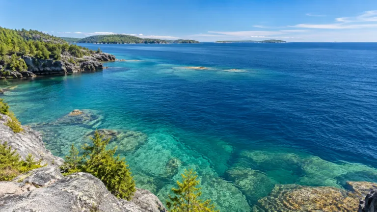
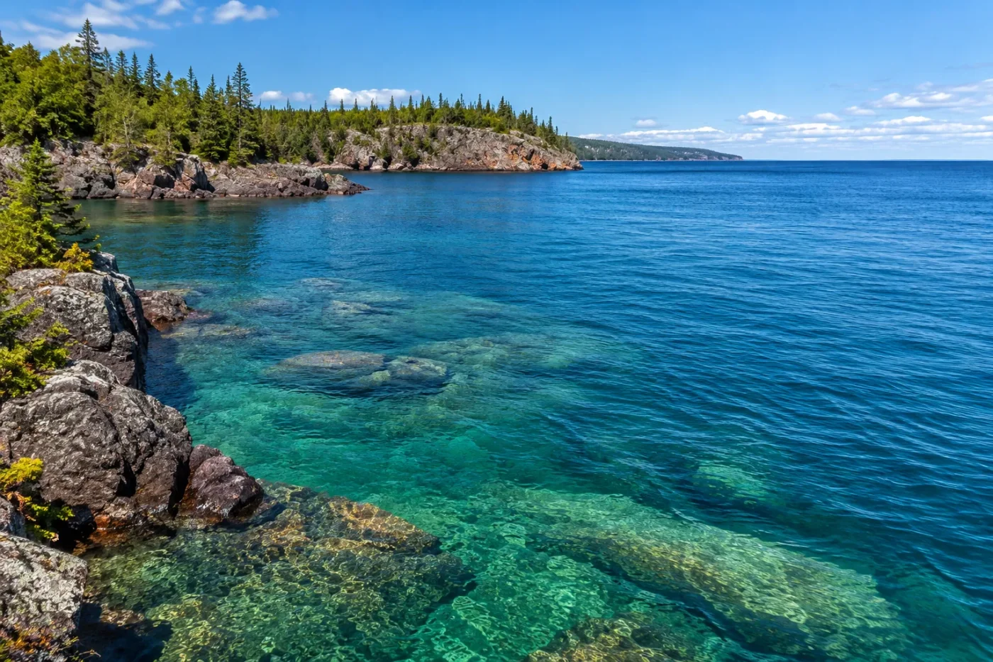
Low productivity and high transparency favor the lake's characteristic blue appearance.
Lower transparency and stronger influence from river and harbor inputs can shift the visible water toward green.
Why Clear Lake Superior Water Looks Blue
Heavy Rain Can Temporarily Recolor the Shoreline
Flood-swollen rivers can carry soil, sediment and other particles into Lake Superior, producing sharply discolored nearshore plumes that contrast with clearer offshore water.
Surface State Through the Year
A Stable Blue Identity with Local Exceptions
Lake Superior is most characteristically deep blue, especially across its clear offshore waters. That blue appearance is closely tied to unusually transparent, low-productivity water, while greener nearshore zones and temporary sediment plumes show that the lake does not have one uniform color everywhere or at all times.
Lake Superior’s Blue Is Closely Tied to Its Exceptional Clarity
Lake Superior sits near the clear-water end of the Great Lakes spectrum. US EPA limnology material describes its blue offshore water as ultra-oligotrophic and gives an estimated Secchi depth of about 15–20 meters. A Secchi disk measures how far into the water a contrasting disk remains visible, so the value provides a useful indication of how little suspended material obstructs light in much of the lake.
This matters optically. Water does not reflect every wavelength of sunlight equally. Red wavelengths are absorbed more strongly, leaving blue wavelengths more apparent in deep, clear water. Suspended particles, algae and dissolved substances can alter that balance by absorbing or scattering different portions of the visible spectrum.
Lake Superior’s low biological productivity helps preserve the blue background rather than routinely pushing the open lake toward the greener appearance associated with higher concentrations of phytoplankton. EPA monitoring also reports that open-water chlorophyll-a concentrations in Lake Superior have remained relatively constant rather than showing the upward pattern seen in some more productive waters.
The Western Arm Can Look Noticeably Greener
The lake’s immense size hides a real spatial difference. EPA limnology data distinguish the clear blue offshore water from greener water in the western arm near Duluth. The listed transparency there is lower than in the clearer offshore zone, reflecting stronger influence from the St. Louis River, harbor waters and suspended material.
That does not mean the entire western end permanently turns green. The useful distinction is between a dominant offshore color and regional water masses whose optical properties are altered by river inputs, particles and other material. As those materials become more concentrated, the light returned from the water can shift away from deep blue.
Flood Runoff Can Produce Sharp Color Boundaries
Some of Lake Superior’s strongest color changes are events rather than seasons. After torrential rain in Wisconsin and northern Michigan in June 2018, swollen rivers carried soil and sediment into the lake. NASA satellite imagery recorded the resulting discolored nearshore water where river plumes entered Lake Superior.
These episodes can create a striking contrast: sediment-rich water near shore next to much clearer offshore water. The boundary may look like a different lake color, but its cause is a short-lived change in the concentration and distribution of suspended particles.
The same distinction matters when interpreting photographs. A shoreline image taken after a flood, storm or strong river discharge may show a color that is real for that place and moment without representing Lake Superior’s usual offshore appearance.
Blue Water Is Not the Same as Blue Liquid in a Glass
Large bodies of clear water develop their visible color through the interaction of sunlight, water molecules, particles and viewing geometry. The deep-blue appearance therefore should not be interpreted as if the water contained a blue pigment.
Surface reflections add another layer. Sky conditions, sun angle, waves and glare can make the same water look darker, lighter or more reflective within minutes. Those are changes in apparent color rather than evidence that the lake’s water chemistry has abruptly changed.
For Lake Superior, the more useful scientific distinction is between clear offshore blue water and water whose optical character has been modified by algae, suspended sediment, river-borne material or surface ice.
Winter Replaces the Open-Water Color with a Changing Ice Mosaic
Lake Superior has a pronounced winter surface cycle, but it should not be pictured as a lake that simply becomes completely frozen for a fixed set of months. NOAA’s long-term record shows large year-to-year differences in the percentage of the lake covered by ice.
For the upper Great Lakes, including Superior, maximum ice cover normally occurs around the end of February to early March. The lake can contain open dark water, newly formed ice, thicker ice and snow-covered areas at the same time. In years with persistent ice, northern portions can retain ice much later into spring.
This winter transformation changes what a satellite image or shoreline observer sees, but it is mainly a surface-state change. It should not be interpreted as an annual chemical color cycle in the water itself.
There Is No Good Basis for Assigning a Different Water Color to Every Month
Lake Superior has well-documented seasonal ice behavior, yet the available evidence does not establish a repeating sequence in which the open lake becomes one specific color in June, another in July and another in August. The dominant clear-water identity is much more stable than that.
Local runoff, storms, river plumes and biological material can still alter visible color on short timescales. Those events may occur during particular seasons, but their timing and intensity depend on weather, watershed discharge and local conditions. Treating them as a fixed twelve-month color schedule would imply more precision than the observations support.
Satellite Color Needs to Be Read with Care
Satellite imagery is especially valuable on a lake as large as Superior because it can reveal sediment plumes and water-mass boundaries that extend far beyond a single shoreline viewpoint. It can also be misleading when the type of imagery is ignored.
A true-color image is designed to resemble colors visible to human eyes, while other satellite products combine wavelengths differently to emphasize temperature, vegetation, sediment, ice or other properties. A bright patch on a processed satellite map is therefore not automatically a literal record of the color a person would have seen from a boat.
For Lake Superior, the strongest color interpretation comes from combining visual observations with water transparency, chlorophyll measurements, sediment evidence and knowledge of the lake’s ice state rather than assigning a color from imagery alone.
Sources