Clear Blue
Primary visual colorWhere Is Þingvallavatn?
Iceland
Drag or zoom the real map. Verified shoreline geometry is highlighted with the lake’s LakeColors palette color when available.
Þingvallavatn on the Globe
Rotate the world or focus directly on the lake.
Measured Optical Clarity and Underwater Light
Documented measurement dataSingle peer-reviewed optical survey; not a modern annual average.
The peak shifted toward 500 nm with depth; this is an underwater spectral measurement, not a surface color code.
The Lake Is Clear, but Transparency Has Changed
Long-term monitoring found lower Secchi transparency and higher pelagic chlorophyll-a than older baselines, while the latest chemistry assessment using 2025 data still places the water body in high physico-chemical status.
Value: Secchi depth declined relative to older records
Provenance: Measured
Evidence: High
Value: Chlorophyll-a increased compared with 1970s–1980s levels
Provenance: Measured
Evidence: High
Value: High status for physico-chemical quality elements
Provenance: Measured
Evidence: High
Open Water and Winter Ice Through the Year
Color Stability
Evidence Behind the Color Profile
Claim-level supportThe official multi-agency monitoring summary identifies clarity and blue color among the lake's conservation values.
Þingvallavatn Monitoring Report 2007–2011Evidence: HighThe park documents groundwater-dominated inflow through lava, while optical research records low attenuation and high transparency.
Thingvellir National Park — Þingvallavatn WatershedThe Underwater Photic Environment of Two Subarctic Icelandic LakesEvidence: HighThe long ice record shows later freeze-up, earlier breakup and many recent winters with shorter or absent complete ice cover.
Natural History Museum of Iceland — Warming and Ice Phenology of ÞingvallavatnEvidence: ModerateThe 2026 monitoring report classifies the lake using 2025 physico-chemical data.
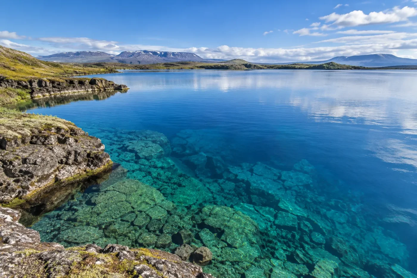
Marine and Freshwater Research Institute — Þingvallavatn Chemistry, 2025 DataEvidence: HighÞingvallavatn is best described as a clear blue rift lake. Its color is tied to unusually transparent, groundwater-fed water: about nine-tenths of the inflow reaches the basin through underground pathways in lava, while optical studies show deep light penetration and low turbidity. That combination favors blue open water instead of the milky turquoise associated with sediment-rich glacial runoff, even though the catchment extends toward Langjökull.
Why the Langjökull Connection Does Not Make the Lake Milky
Þingvallavatn sits in an active rift landscape, and the geology controls how water reaches it. After the last glacial period, lava flows changed the drainage network north of the lake. Water that could once arrive as murky glacial runoff was redirected into porous volcanic ground, where much of it now travels underground before re-emerging around the basin.
The national park estimates that roughly 90% of the lake’s inflow arrives through subterranean channels. This matters for color because the lake is not fed mainly by a visibly sediment-laden river. The long underground route reduces the direct delivery of suspended glacial material and helps maintain the unusually clear water for which Þingvallavatn is known.
What the Water-Column Measurements Show
A peer-reviewed optical survey on 10 August 1989 recorded Secchi transparency of about 12–16 metres in Þingvallavatn, far greater than in the eutrophic Icelandic lake used for comparison in the same study. The researchers also measured an upward-light transmission maximum that shifted from about 480 to 500 nanometres with depth.
The 480–500 nm result describes underwater light transmission, not a fixed surface RGB value. Surface color can look deeper blue, lighter blue or somewhat blue-green as depth, sky, cloud, wind and viewing angle change.
The useful scientific point is not that the lake has one exact wavelength-defined color. It is that the water column transmits light deeply and has an optical environment consistent with very clear water, reinforcing the documented blue appearance.
Clear Water Does Not Mean Unchanging Transparency
Þingvallavatn’s blue identity should not be read as a claim that clarity never varies. The multi-agency monitoring programme found that Secchi depth had declined compared with older records while pelagic chlorophyll-a had risen. More phytoplankton increases light absorption and scattering, so biological change can soften transparency without turning the lake into a different color class.
At the same time, the Marine and Freshwater Research Institute’s 2026 report, based on samples through 2025, classifies Þingvallavatn in high status for physico-chemical quality elements. These two findings describe different parts of the same system: the lake can retain very good chemical condition while long-term optical clarity still deserves monitoring.
A high chemistry classification does not erase a measured transparency trend, and a lower Secchi depth does not by itself mean the lake has lost its clear-blue identity.
Winter Mostly Changes the Surface, Not the Defined Water Color
Ice phenology records show that complete freezing has become less frequent as Þingvallavatn has warmed. When the lake does freeze, freeze-up tends to occur later and breakup earlier than it did during colder decades. The dates have varied widely from winter to winter, and some recent winters in the long record had little or no complete ice cover.
For a color database, that distinction matters. Winter ice and snow can hide the open-water blue from view, but the best-supported annual change is a surface-state transition rather than a recurring chemical shift from blue to another water color. Once open water returns, the same groundwater-fed clarity again dominates the lake’s visual identity.
Sources
- Thingvellir National Park — Þingvallavatn Watershed
- Þingvallavatn Monitoring Report 2007–2011
- The Underwater Photic Environment of Two Subarctic Icelandic Lakes
- Natural History Museum of Iceland — Warming and Ice Phenology of Þingvallavatn
- Marine and Freshwater Research Institute — Þingvallavatn Chemistry, 2025 Data
- Wikidata — Þingvallavatn Geographic Record